Interactive UK Map Overview
Dominate data aggregation across the British Isles using our robust Interactive Map of United Kingdom WordPress Plugin. This scalable tool converts standard map layers into a high-precision, clickable graphic that seamlessly unifies England, Scotland, Wales, and Northern Ireland. Engineered explicitly for corporate networks operating in high-growth technology, logistics, and real estate sectors, this SVG map asset delivers quick mobile loading speeds and flawless responsive design without draining your web hosting environment.
Main Features
Everything included with the Interactive UK Map plugin.
Map Capabilities
Every Region, Individually Clickable
All 12 regions, each its own clickable region — not one flat image.
Visual Editor, No Code
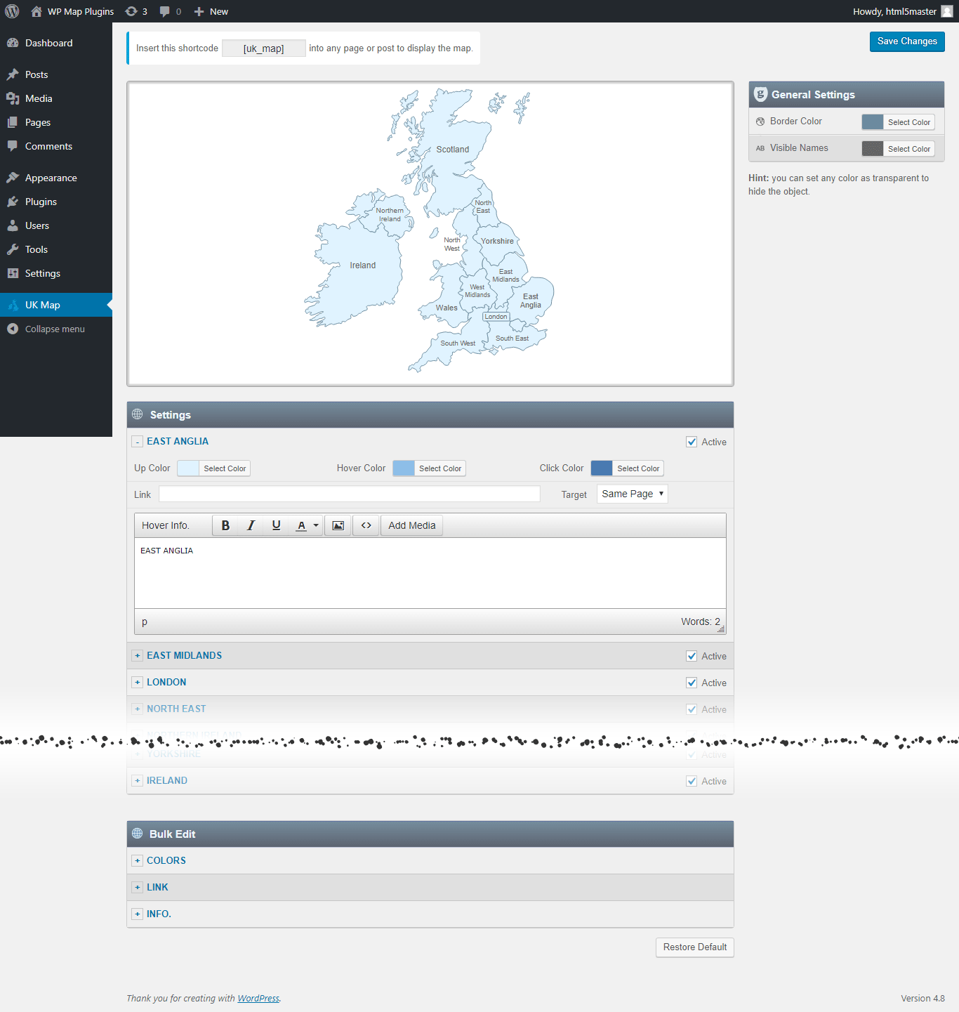
Set a color, a link, and a hover popup for any region directly in the WordPress editor.
SVG — Always Sharp
Vector graphics, so the map stays crisp on everything from a phone to a 4K monitor.
No iframe, No External API
The map loads with your page — no embed, no third-party map service, no API key to manage.
Custom Hover Popups
Add text, images to the hover Popup. And link each region to any URL.
One Shortcode to Install
Drop a single shortcode into any post, page, or widget area — no theme editing required.
Multiple Maps, One Site
Build up to 3 instances of the map on your site, each with its own colors, links, and popups.
Popup Maker Integration
New Trigger a full Popup Maker popup from any region click for more advanced layouts.
Watch a Video →Why Get It From Us
No Trial, No Expiration
This is the full free version of the plugin, ready to use on your site — not a time-limited trial.
Free Lifetime Updates
Every future update to this plugin is included at no extra cost.
Support From the Developer
Questions go directly to the person who built the plugin, not a ticket queue.
Common Ways Businesses Use This Map
See a few examples of how businesses rely on the Interactive UK Map plugin.
National Retail Franchise Store Finders
Directing online consumers to regional distributor networks, major corporate outlets, or localized retail storefronts.
FinTech Expansion and Wealth Management Footprints
Showcasing localized corporate banking headquarters, secure data centers, and active client territories centered near London.
Logistics, Freight, and Last-Mile Delivery Networks
Color-coding localized shipping zones, automated fulfillment centers, and highway freight transit routes across the UK.
List of the clickable regions in the UK map
Each region can be customized independently (colors, link, hover information, etc).
- East Anglia
- East Midlands
- London
- North East
- Northern Ireland
- North West
- Scotland
- South East
- South West
- Wales
- West Midlands
- Yorkshire
- Ireland
Get This Plugin Free
The Interactive UK Map plugin is completely free. Enter your name and email below and we'll send the download link straight to your inbox.
Frequently Asked Questions
Find answers to common questions about the Interactive UK Map WordPress Plugin.
Can I add an image in the hover popup?
Yes. You can add text and images to the hover popup. However, we recommend keeping the hover popup content concise and using the modal window option for more detailed content.
Can I add clickable links in the hover popup?
You can link each clickable area to any URL, but the hover popup itself does not support clickable links. If you need more detailed content with clickable links, you can use the modal window option together with the Popup Maker plugin. This allows you to open a modal window containing as much text, clickable links, and images as needed. Watch a Video →
Can I create another map with different style in my website?
Yes. The full version includes 3 installable instances of the plugin, allowing you to create a second and third map with different colors, links, and other settings. Each map has its own dedicated shortcode.
Do you offer special customization if needed?
Yes. We offer custom development and customization services, including:
- Merging or splitting regions.
- Creating a completely new map from scratch.
- Adding or removing regions.
- Adding custom legend, or other map elements.