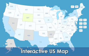
50 Independent US State Maps Bundle Overview
Drill down into hyper-local regional analytics using our comprehensive 50 Individual US State Maps Package tailored for WordPress. Instead of relying on a broad, cluttered country-wide view, this premium toolkit gives you individual, lightweight vector plugins for every single US state, cleanly divided into clickable counties. This approach prevents bulky script performance loss while offering unparalleled geographic flexibility. Whether managing regional operations, political distributions, or localized franchise storefronts, this bundle grants complete localized data control with an intuitive bulk-edit dashboard and zero coding requirements.
Main Features
Everything included with the bundle.
Map Capabilities
Every County, Individually Clickable
All 3000+ counties, each its own clickable region — not one flat image.
Visual Editor, No Code
Set a color, a link, and a hover popup for any region directly in the WordPress editor.
SVG — Always Sharp
Vector graphics, so the map stays crisp on everything from a phone to a 4K monitor.
No iframe, No External API
The map loads with your page — no embed, no third-party map service, no API key to manage.
Custom Hover Popups
Add text, images to the hover Popup. And link each region to any URL.
One Shortcode to Install
Drop a single shortcode into any post, page, or widget area — no theme editing required.
Multiple Maps, One Site
Build up to 3 instances of the map on your site, each with its own colors, links, and popups.
Popup Maker Integration
New Trigger a full Popup Maker popup from any region click for more advanced layouts.
Watch a Video →Why Get It From Us
One-Time Purchase
No subscription — pay once and the plugin is yours.
Free Lifetime Updates
Every future update to this plugin is included at no extra cost.
Support From the Developer
Questions go directly to the person who built the plugin, not a ticket queue.
Common Ways Businesses Use This Map
Statewide Real Estate Aggregators
Linking distinct counties directly to MLS property feeds, local brokerage offices, or county housing market reports.
Political and Election Campaign Tracking
Visualizing regional polling numbers, voter turnout targets, or historical county-by-county ballot statistics.
Regional Service and Trade Franchises
Directing localized consumers to specific service technicians, available delivery corridors, or regional business contractors.
Public Health and Environmental Dissemination
Displaying epidemiological tracking data, localized environmental metrics, or municipal resource availability.
State Parks and Tourist Directories
Highlighting historical landmarks, natural trail maps, and localized state park campgrounds by county.
List of the included state map plugins:
Each state map plugin installed and customized independently.
- Massachusetts
- Michigan
- Minnesota
- Mississippi
- Missouri*
- Montana
- Nebraska
- Nevada
- New Hampshire
- New Jersey
* Some state maps are divided into 100 counties or more ( 8 States: Georgia, Illinois, Kansas, Kentucky, Missouri, North Carolina, Texas, and Virginia ) and that's a huge number for WordPress to be customized through a visual editor. So those maps don't have a Visual Editor but can be customized by editing a simple plugin file, please watch this short video tutorial for more information, and feel free to contact us if you have any questions.