Interactive Map of South America Overview
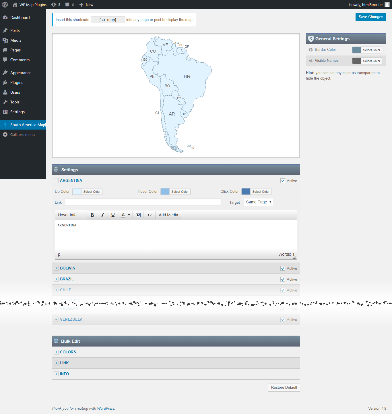
South America's map includes all 12 sovereign nations plus French Guiana and the Falkland Islands, for 14 clickable regions covering everything from the Andean countries to the Amazon basin and the Southern Cone. It's a useful base for import/export directories tracking commodities like coffee, soy, or copper by country, conservation sites reporting on Amazon initiatives, or adventure travel operators organizing itineraries by destination. Every region is independently customizable — color, link, hover or popup content — through the visual dashboard, and the finished map goes live anywhere with a shortcode.
Main Features
Everything included with the Interactive Map of South America plugin.
Map Capabilities
Every Country, Individually Clickable
All 14 countries, each its own clickable region — not one flat image.
Visual Editor, No Code
Set a color, a link, and a hover popup for any region directly in the WordPress editor.
SVG — Always Sharp
Vector graphics, so the map stays crisp on everything from a phone to a 4K monitor.
No iframe, No External API
The map loads with your page — no embed, no third-party map service, no API key to manage.
Custom Hover Popups
Add text, images to the hover Popup. And link each region to any URL.
One Shortcode to Install
Drop a single shortcode into any post, page, or widget area — no theme editing required.
Multiple Maps, One Site
Build up to 3 instances of the map on your site, each with its own colors, links, and popups.
Popup Maker Integration
New Trigger a full Popup Maker popup from any region click for more advanced layouts.
Watch a Video →Why Buy From Us
One-Time Purchase
No subscription — pay once and the plugin is yours.
Free Lifetime Updates
Every future update to this plugin is included at no extra cost.
Support From the Developer
Questions go directly to the person who built the plugin, not a ticket queue.
Common Ways Businesses Use This Map
A country-by-country South America map suits sites that need to say something different about the Andes, the Amazon basin, and the Southern Cone rather than treat the continent as one block:
Import/export directories
mark countries by commodity (coffee, soy, copper) with country-specific sourcing info.
Conservation and NGO sites
highlight Amazon basin countries and link to project pages.
Adventure travel operators
mark trekking or tour destination countries.
Study-abroad programs
link partner universities by country.
Mining and agriculture sites
show operational countries and local details.
List of the clickable countries in the map of South America
Each country can be customized independently (colors, link, hover information, etc).
- Argentina
- Bolivia
- Brazil
- Chile
- Colombia
- Ecuador
- Falkland Islands
- French Guiana
- Guyana
- Paraguay
- Peru
- Suriname
- Uruguay
- Venezuela
Are you looking for other continent maps?
This is a package of the 6 individual continent map plugins with clickable countries. Install and customize each continent map plugin independently.
- Interactive Map of Africa
- Interactive Map of Asia
- Interactive Map of Europe
- Interactive Map of North America
- Interactive Map of Oceania
- Interactive Map of South America
Frequently Asked Questions
Find answers to common questions about the Interactive Map of South America WordPress Plugin.
Can I add an image in the hover popup?
Yes. You can add text and images to the hover popup. However, we recommend keeping the hover popup content concise and using the modal window option for more detailed content.
Can I add clickable links in the hover popup?
You can link each clickable area to any URL, but the hover popup itself does not support clickable links. If you need more detailed content with clickable links, you can use the modal window option together with the Popup Maker plugin. This allows you to open a modal window containing as much text, clickable links, and images as needed. Watch a Video →
Can I create another map with different style in my website?
Yes. The full version includes 3 installable instances of the plugin, allowing you to create a second and third map with different colors, links, and other settings. Each map has its own dedicated shortcode.
Do you offer special customization if needed?
Yes. We offer custom development and customization services, including:
- Merging or splitting regions.
- Creating a completely new map from scratch.
- Adding or removing regions.
- Adding custom legend, or other map elements.