Table of Contents
- Scalability and Resolution Independence
- Retina Display and High-DPI Screen Performance
- File Size and Bandwidth Efficiency
- Rendering Performance and Browser Processing
- Interactivity, Accessibility, and SEO
- When to Use SVG Maps
- When to Use PNG Maps
- SVG vs. PNG: A Performance Case Study
- Conclusion
1. Scalability and Resolution Independence
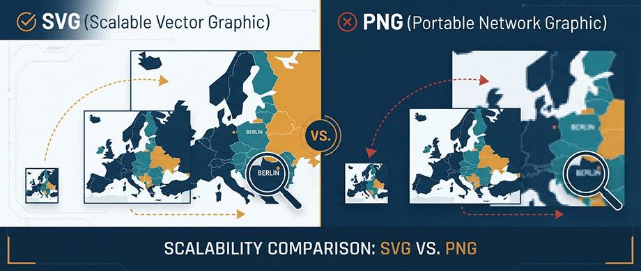
Infinite Scalability with SVG
The defining feature of SVG is its resolution independence. Because SVG images are based on mathematical formulas rather than fixed pixels, they can be scaled to any size without losing quality. Whether viewed on a small mobile device or a large desktop monitor, SVG images maintain their clarity and sharpness.
For maps, this means:
- Zoom without pixelation: Users can zoom in on map details without seeing blurry edges.
- Responsive across devices: One SVG file works perfectly on phones, tablets, and desktops.
- Future-proof design: SVG adapts to new display technologies seamlessly.
The PNG Limitation
PNG images have a fixed resolution defined by their pixel dimensions. When you enlarge a PNG beyond its intended size, the software must invent new pixels through a process called interpolation, resulting in the dreaded blurriness or "pixelation".
This is particularly problematic for maps because:
- Users expect zoom capability: Interactive maps invite exploration and close-up viewing.
- Retina displays demand high resolution: A standard PNG may look blurry on modern screens.
- Multiple device sizes require multiple assets: You may need different PNG versions for different screens.
The Analogy
Think of a raster image like a specific, fixed-resolution print of a painting—zoom in too far, and you see individual dots of ink. A vector graphic is like the artist's original schematic—a set of instructions that can reproduce the painting accurately at any size on any canvas.
2. Retina Display and High-DPI Screen Performance
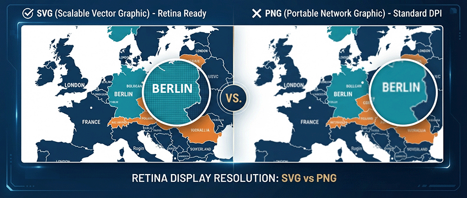
Why SVG Excels on Retina Displays
SVG images are ideal for high-density displays, such as Retina screens on Apple devices. Unlike bitmap images that can appear pixelated on these screens, SVGs retain their sharpness and clarity even when scaled up.
For web maps, this means:
- Crisp text labels: Place names and descriptions remain readable at any zoom level.
- Sharp borders and boundaries: Country outlines, property lots, and route paths stay clean.
- Professional appearance: Your maps look polished on premium devices.
The PNG Retina Challenge
To achieve sharp appearance on retina displays with PNG, you must export images at 2x or 3x resolution. This means:
- Larger file sizes: A 2x PNG is four times larger than standard resolution.
- More bandwidth usage: Higher resolution images take longer to load.
- Potential image degradation: Scaling algorithms can introduce artifacts.
One alternative for PNG maps is 2x oversampling ("retina" mode), which produces sharper images but significantly increases file size. For PNG maps, a common solution is 2x oversampling ("retina" mode), which produces sharper images but significantly increases file size. A PNG optimized for a standard screen can easily be 2x to 4x larger when prepared for high-DPI displays, directly impacting page load speed.
3. File Size and Bandwidth Efficiency
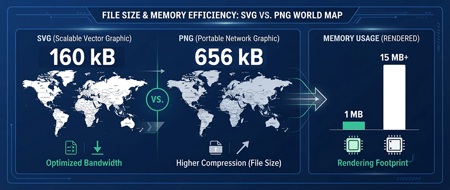
When SVG Is Smaller
Whether SVG or PNG produces a smaller file depends on the image content. For maps with clean lines, simple shapes, and limited colors, SVG is often significantly smaller.
Consider this real-world comparison: SVG maps achieve this efficiency by storing data as instructions (lines and curves) rather than pixels. A world map as an SVG might be a few hundred kilobytes, while a PNG version prepared for high-resolution displays could easily balloon to many megabytes—a significant difference for users on slower connections.
SVG maps achieve this efficiency because:
- No pixel data for "empty" space: SVG only stores the lines and curves of your map, not all the white space pixels between them.
- Compression effectiveness: SVG is highly compressible and lightweight.
- Text as actual text: Labels are stored as text strings, not rendered pixels.
When PNG Is Smaller
At very small dimensions, PNG may be much smaller than SVG. For example, a 1px x 1px PNG only needs to store one pixel of data, while an SVG still contains the complete vector instructions.
PNG can also be more efficient for:
- Photorealistic map backgrounds: Satellite imagery or detailed terrain renderings.
- Highly complex vector art: Maps with thousands of detailed paths can create large SVG files.
- Static maps with limited use cases: If the map only needs one fixed size, PNG may suffice.
4. Rendering Performance and Browser Processing
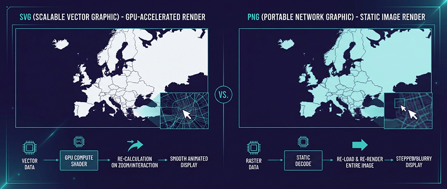
The SVG Rendering Cost
While SVG offers flexibility and scalability, this flexibility depends on doing computations at display time, rather than when the author created the image. For maps with complex gradients and filters, this work must be done each time the SVG is displayed.
SVG performance considerations include:
- Complexity matters: Rendering time is proportional to the number of elements in the SVG.
- GPU acceleration helps: It can be faster to send vector information to a user's GPU than to extract raster data from an equivalent raster image.
- Element count limits: For maps with thousands of polygons or paths, performance may suffer.
One practical example: The cost of SVG's flexibility is computational. Rendering a highly complex SVG with thousands of data points can require significant browser processing, potentially slowing down the user experience. In contrast, a PNG of a similar map has a fixed, predictable load time, as the rendering work was done when the image was created.
The PNG Rendering Advantage
PNG images render with consistent, predictable performance because all the work to create the image happens on the author's computer before the result is stored. When displayed, the image is simply loaded and shown—no complex calculations required.
PNG rendering benefits:
- Constant rendering time: Performance depends on file size, not complexity.
- Predictable behavior: No surprises with complex vector calculations.
- Works everywhere: PNG support is universal across all browsers and devices.
Performance Best Practices
For interactive maps, consider these performance guidelines:
- Use SVG for simple maps: Country boundaries, travel routes, property lots with clean lines.
- Use PNG for complex backgrounds: Satellite imagery, detailed terrain, photorealistic elements.
- Limit element count: For SVG maps, keep under 100 pins for best performance.
- Optimize SVG files: Remove unnecessary paths, simplify geometries, and use compression tools.
5. Interactivity, Accessibility, and SEO
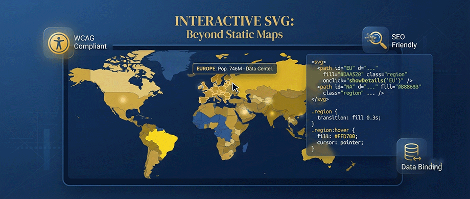
SVG Supports Rich Interactivity
SVG images are inherently interactive. Because they're text-based XML documents, they support:
- Clickable regions: Each country, state, or district can respond to clicks.
- CSS styling: Colors, hover effects, and animations can be controlled with standard CSS.
- JavaScript events: Click, hover, zoom, and pan actions can be customized.
- Dynamic updates: Map data can be changed without reloading the page.
This makes SVG the ideal format for interactive maps where users need to click regions, view tooltips, or filter data.
Accessibility and SEO Benefits
SVG provides important advantages for accessibility and search engine optimization:
- Text accessibility: Labels and descriptions in SVG are accessible to screen readers.
- Search indexable: Search engines can read and index SVG text content.
- Schema.org integration: Map plugins can automatically output Schema.org/Place JSON-LD for search visibility.
PNG Limitations
PNG images are essentially flat, with limited interactivity capabilities:
- No native interactivity: Clicks and hovers require additional JavaScript layers.
- Text is rendered as pixels: Screen readers cannot access text labels.
- Limited SEO benefit: Search engines cannot read text embedded in images.
6. When to Use SVG Maps
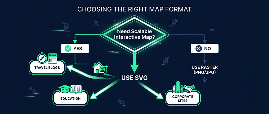
Ideal Use Cases for SVG
Choose SVG maps when you need:
- Scalable maps: Travel routes, world maps, real estate portfolios that need to work at any size.
- Interactive features: Clickable regions, hover tooltips, zoom, pan.
- Responsive design: One map that works on all devices without multiple versions.
- Retina display support: Crisp appearance on high-DPI screens without file size penalties.
- Search engine visibility: Text-based format helps with SEO.
- Brand consistency: Easy to customize colors and styles with CSS.
Popular SVG Map Applications
- Travel blogs: Interactive journey maps with clickable destinations.
- Real estate websites: Property portfolios organized by neighborhood with custom pins.
- Educational content: Geography maps with clickable regions for learning.
- Store locators: Business locations with clickable branches and directions.
- Corporate sites: Office locations, global presence, and regional landing pages.
7. When to Use PNG Maps
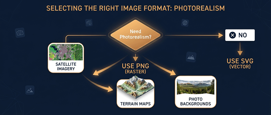
Ideal Use Cases for PNG
Choose PNG maps when you need:
- Photorealistic imagery: Satellite views, aerial photos, terrain renderings.
- Complex gradients and textures: Detailed shading that would create massive SVG files.
- Fixed display sizes: Maps that only need one resolution for a specific purpose.
- Simple image display: When no interactivity is required.
- Legacy browser support: PNG works everywhere, even very old browsers.
Popular PNG Map Applications
- Satellite map backgrounds: Photo-based map tiles.
- Terrain visualization: Complex elevation and shading.
- Static map images: Non-interactive maps in articles or PDFs.
- Heatmaps and density maps: Data visualizations with complex color blending.
- Email campaigns: PNG has better email client support than SVG.
8. SVG vs. PNG: A Performance Case Study
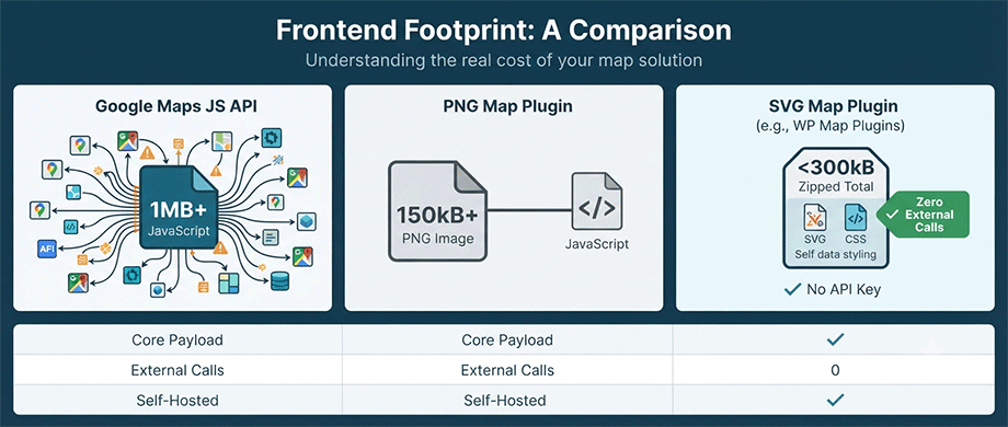
To put the performance differences into perspective, let's compare the frontend footprint of different mapping solutions::
- Google Maps JavaScript API: The core library for a basic embed is often over 1MB of compressed JavaScript before any map data is even loaded. This initial payload alone can significantly delay page rendering.
- A Typical Interactive PNG Map Plugin: A plugin based on raster tiles might load a single 2x PNG map image that is over 150kB, often requiring additional JavaScript libraries for interactivity, leading to a larger total footprint.
- An SVG Map Plugin (e.g., WordPress Map Plugins): A responsive SVG world map with custom colors and tooltips can have a frontend asset size of under 300kB zipped. Because all the map data is contained in the self-hosted SVG, there are zero external API calls, no bulky third-party libraries, and no Google Maps key required. The total impact on page load is minimized, resulting in faster Time to Interactive (TTI) compared to API-dependent or large-raster solutions.
Conclusion: Choose the Right Map Format for Your Needs
The choice between SVG and PNG maps comes down to your specific use case, performance requirements, and user expectations. Both formats have their place in modern web design.
Choose SVG maps when you need:
- Infinite scalability and crispness on retina displays.
- Interactive features like clickable regions and tooltips.
- SEO benefits and accessibility through text-based content.
- Small file sizes for simple, clean map designs.
- Self-hosting without external API dependencies.
Choose PNG maps when you need:
- Photorealistic imagery like satellite views and terrain.
- Complex gradients and textures.
- Simple, static map display without interactivity.
- Support for very old browsers or email clients.
For most travel blogs, real estate websites, and interactive content, SVG maps offer superior scalability, interactivity, and performance—all without per-request fees or API dependencies. The ability to customize colors, add clickable pins, and style with CSS makes SVG the modern choice for web mapping.
If you are ready to create beautiful, scalable, and fast-loading interactive maps for your WordPress website, discover how our premium Interactive WordPress Map Plugins can help you build stunning SVG maps—with zero external dependencies, retina-ready design, and complete SEO optimization built in.

About the Author
Botrous Kerolos has been designing and building interactive maps for the web since 2009 — from early Flash/SWF maps to modern SVG — and leads development at WP Map Plugins, helping WordPress sites turn static content into fast, accessible, interactive experiences.