Table of Contents
- Store Locators: Making Your Locations Findable
- Delivery Zones: Defining Service Areas Clearly
- Service Area Maps: Showing Coverage for Mobile Businesses
- Multi-Location Franchise and Dealer Networks
- Visual Territory Planning and Regional Coverage
- Branding and Customer Experience
- Measuring Impact and Optimization
- Conclusion
1. Store Locators: Making Your Locations Findable
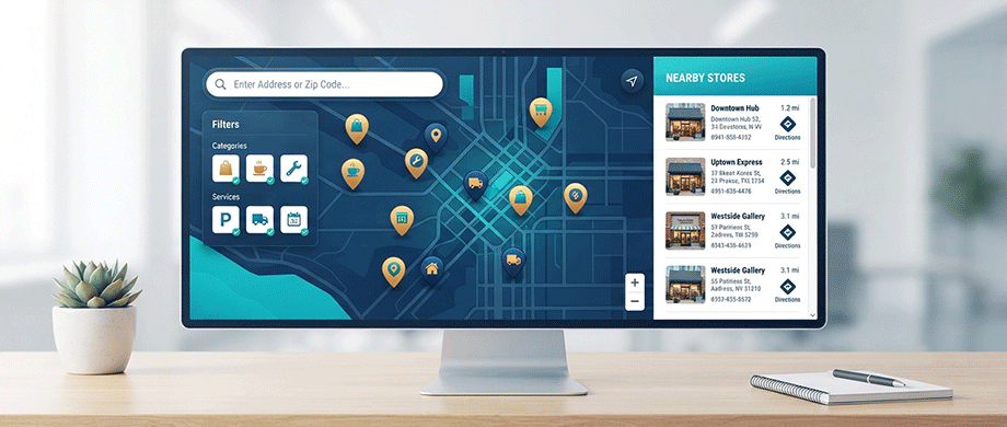
The Customer Journey Starts with "Near Me"
Nearly half of all mobile searches have local intent, and searches containing "near me" have grown over 500% in recent years. When customers look for your business, they want to know where you are relative to their current location. A well-designed store locator is the most direct way to answer that question.
For multi-location businesses—retail chains, franchises, service providers, and dealers—a store locator serves as a digital storefront that guides customers from search to visit with minimal friction.
Essential Store Locator Features
Geolocation Detection: The locator should automatically detect the user's location and show the nearest stores first. This eliminates the need for customers to enter their address manually.
Search and Filter: Users should be able to search by city, zip code, postcode, or keyword with autocomplete suggestions as they type. Filters allow narrowing results by product, service, or any category you define.
Comprehensive Store Details: Each listing should display opening hours with live open/closed status, action buttons, booking links, phone numbers, and images. One-tap directions via Google Maps, Apple Maps, or Waze are essential for mobile users.
Visual Branding: Custom map markers with your logo and brand colors reinforce recognition. Users should feel they're interacting with your brand, not a generic mapping tool.
Multi-Location Management
For businesses with many locations, efficient management is critical. Store locator solutions offer:
Bulk Import: Add or update locations in bulk rather than one at a time — most store locator tools support CSV import, and some offer live syncing with spreadsheet tools so your locator updates automatically as your data changes.
Categories and Tags: Tag locations with products, services, or categories. Add colors and images to each tag so visitors can browse visually. Group tags into filter sets that match how your business works.
Analytics: Search analytics show which areas get the most traffic and where gaps in coverage exist. This data helps optimize store placement and marketing efforts
2. Delivery Zones: Defining Service Areas Clearly
Why Delivery Zones Matter
A customer finds your restaurant online, spends ten minutes building the perfect order, heads to checkout—and discovers you don't deliver to their address. Or worse, they see a delivery fee so high it kills their appetite entirely. Both scenarios end the same way: an abandoned cart and a customer who probably won't come back.
This is the reality for local businesses that skip proper delivery zone configuration. Unlike e-commerce stores shipping nationally through carriers, restaurants and local delivery services operate within tight geographic radiuses where every mile matters.
Defining Delivery Zones
Most successful delivery operations use a combination of approaches like this example:
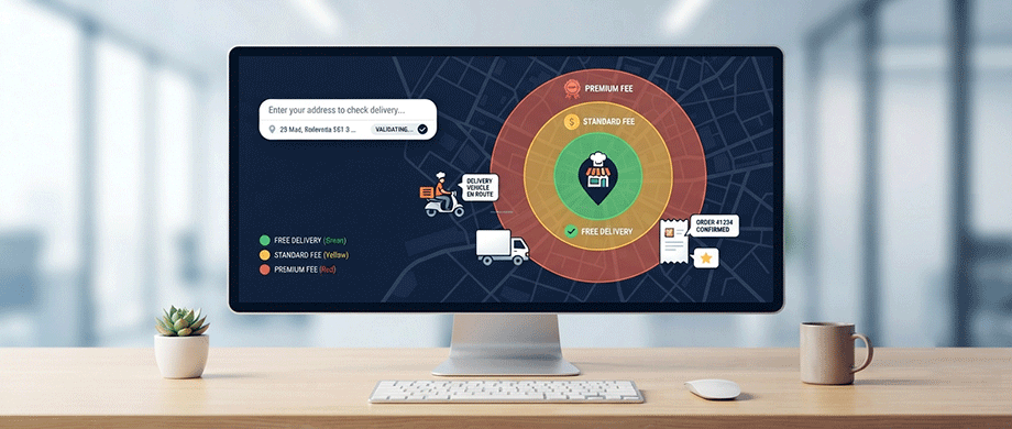
Zone 1: Distance [0–3 miles] - Delivery Fee [Free] - Minimum Order $15.
Zone 2: Distance [3–6 miles] - Delivery Fee [$4.99] - Minimum Order $25.
Zone 3: Distance [6–10 miles] - Delivery Fee [$6.99] - Minimum Order $35.
Beyond: Distance [10+ miles] - Delivery Fee [Unavailable] - Minimum Order N/A.
This structure accomplishes several things simultaneously.
- Prevents unprofitable small orders from distant locations.
- Incentivizes larger orders through free delivery thresholds.
- Nudges average order value upward.
- Keeps closest, most loyal customers happy.
Distance-Based Delivery Fees
For precise address-level delivery fee calculations, you'll need a plugin or platform that integrates with a mapping service to calculate actual driving distances between your business and the customer's address, rather than relying on straight-line distance.
A common pricing structure looks like:
- 0–3 miles: Free delivery (or $1.99).
- 3–6 miles: $0.75 per mile beyond 3 miles.
- 6–10 miles: $1.25 per mile beyond 6 miles.
- Beyond 10 miles: Delivery unavailable.
Visual Delivery Zone Maps
Consider embedding a simple map on a dedicated "Delivery Info" page that visually shows your coverage area. You can create this using a tool that generates a map from your zone settings. A visual map answers the "do you deliver to me?" question instantly—no address entry required for a quick check.
Some restaurant ordering platforms allow you to draw delivery zones directly on a map, set per-zone delivery fees, and restrict ordering entirely outside your service area. This visual approach is far more intuitive than juggling ZIP codes manually.
3. Service Area Maps: Showing Coverage for Mobile Businesses
When You Go to Your Customers
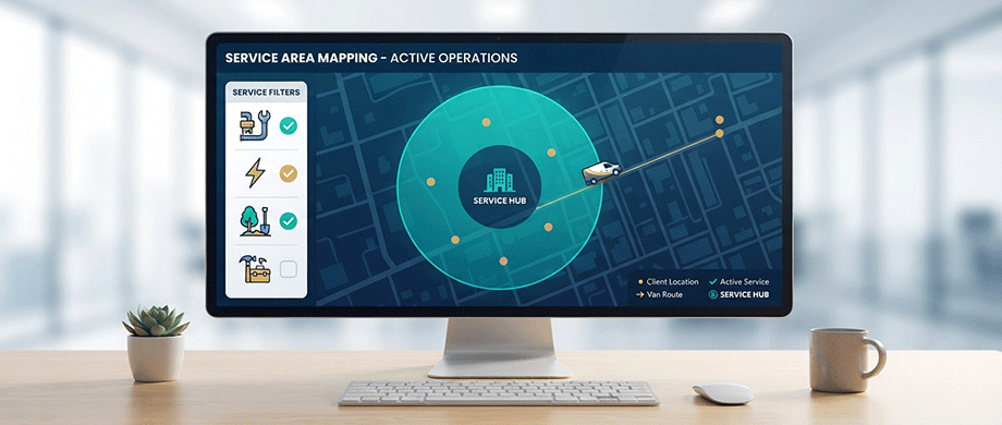
For businesses that come to the customer—plumbers, electricians, landscapers, mobile pet groomers, and home services—a service area map is essential. Unlike store locators that send customers to you, service area maps show customers where you'll go.
A service area map typically displays a radius around your business location or office, showing the geographic region within which you provide services. This helps potential customers quickly determine if you serve their area before they contact you.
Benefits of Service Area Maps
Better Lead Qualification: If customers know you don't service their area, they won't contact you—saving everyone time. Conversely, customers who were unsure will be more likely to reach out when they see you cover their location.
Local SEO Boost: Embedding a service area map on your website helps with local search visibility. Combined with a business listing and citation (name, address, phone number), it can help your website show up in the Google Local Map Pack.
Multiple Location Strategy: For businesses with multiple offices or hubs, embed a service area map on each location page. Search engines can then send people to the specific page for services in their area—improving relevance and conversion.
Creating Service Area Maps
Several tools let you create interactive service area maps:
- Enter your business address and define your service radius.
- Choose zoom level and map style.
- Generate an embed code to add to your website.
- Some tools even offer free business listings for SEO purposes.
For complex service areas that don't follow simple radius boundaries—perhaps covering entire counties or specific neighborhoods—some platforms allow selecting states or regions individually.
4. Multi-Location Franchise and Dealer Networks
Managing Complex Location Networks
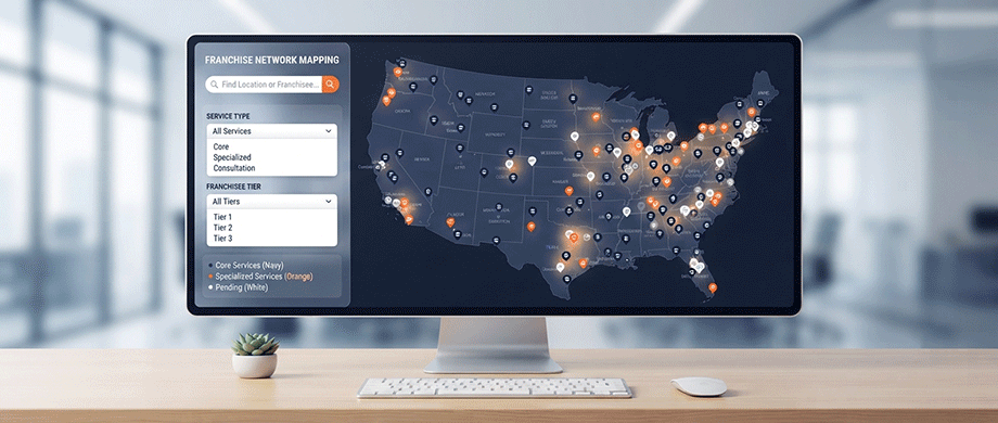
For franchises, dealer networks, and brands with hundreds or thousands of locations, organizing and displaying locations requires specialized tools. The challenge scales with your network: 10 locations need a simple list; 10,000 locations need robust search, filtering, and real-time data synchronization.
Store locator solutions for large networks offer:
- Location management for up to 10,000+ locations.
- Bulk import via CSV or Google Sheets sync.
- Pre-filtered embeds showing specific products or location types on different pages.
- Territory and service area definitions.
- Promotions and targeted messaging by location.
- User roles for franchisee-level management.
Category and Service Filtering
Large networks often offer different services or product categories across locations. Filtering allows customers to narrow results by what they need:
- Product availability (e.g., "in stock at this store").
- Services offered (e.g., "oil changes available").
- Store type (e.g., "flagship store," "express location").
- Special features (e.g., "wheelchair accessible," "EV charging").
Data Integration and Synchronization
For multi-location businesses, location data changes frequently—new stores open, hours change, services update. Solutions that sync with Google Sheets or external databases ensure your locator stays current without manual re-uploading.
5. Visual Territory Planning and Regional Coverage
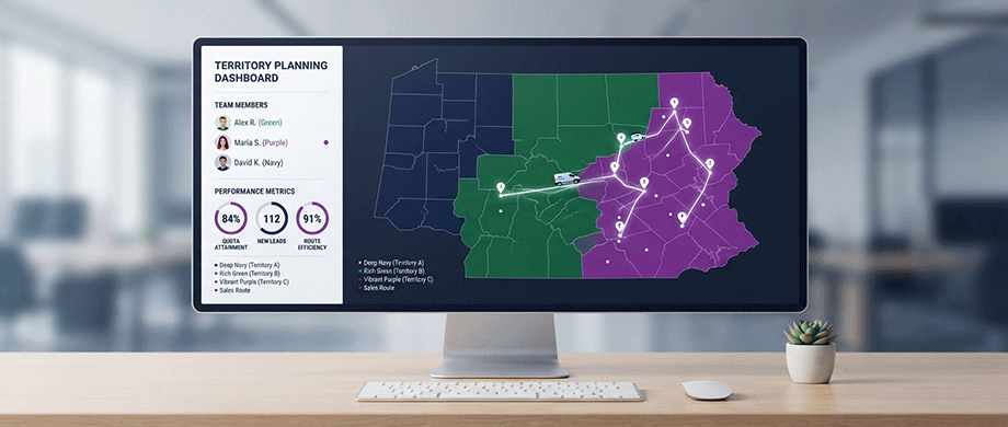
When Coverage Needs to Be Defined by Boundaries
Some businesses need to define coverage by boundaries rather than simple radiuses: sales territories, school districts, franchise regions, or service coverage for utilities and telecom providers. These use cases require more sophisticated mapping tools that work with polygon-based boundaries.
Sales Territories: Define regions for sales representatives with custom boundaries. Show which territories are covered and which have gaps.
Utility and Telecom Coverage: Show customers where service is available based on infrastructure boundaries rather than simple radiuses.
Public Services: Emergency responders, schools, and government agencies define coverage by administrative boundaries—counties, school districts, or evacuation zones.
Key Features for Territory Mapping
Custom Boundaries: Upload or draw custom shapes for territories—states, counties, ZIP codes, or custom-drawn polygons.
Layer Management: Toggle different layers on and off—roads, landmarks, infrastructure, coverage boundaries.
Real-Time Updates: For dynamic coverage (like network availability), maps should update as coverage expands or changes.
6. Branding and Customer Experience
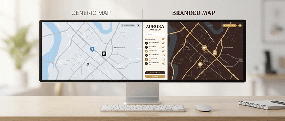
Making Maps Feel Like Your Brand
A map is often the most interacted-with element on a local business website. It should feel like part of your brand, not a generic embed. Customization options that matter.
Custom Markers: Upload map markers with your logo, brand colors, or custom icons. A restaurant might use a fork icon; a retail store might use a shopping bag.
Color Schemes: Match map colors to your brand palette—land colors, water colors, pin colors, tooltip styling.
Typography: Use your brand fonts for labels and tooltips.
Map Styles: Choose from different map themes—contemporary, traditional, or custom. Make rivers or landmarks stand out to emphasize local geography.
Consistent User Experience
Your maps should work seamlessly across all devices—desktop, tablet, and mobile. Touch controls should be intuitive for mobile users, with large tap targets for pins and buttons.
7. Measuring Impact and Optimization
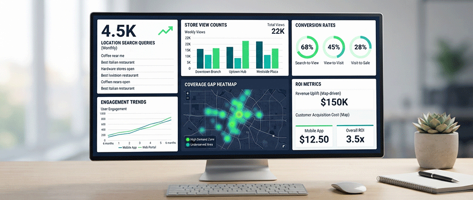
Data That Informs Decisions
Most mapping solutions provide analytics that reveal how customers interact with your maps:
Location Search Queries: Which areas or zip codes are customers searching from? This reveals demand in specific regions.
Location Views: Which stores or locations get the most views? This helps you understand which locations are most attractive or perhaps which need more promotion.
Coverage Gaps: Where are customers searching but no locations exist? This identifies expansion opportunities.
Conversion Tracking: How many map views lead to calls, directions requests, or bookings? This measures ROI.
Optimizing Your Mapping Strategy
Use analytics to refine your approach:
- Add locations in high-demand areas with no coverage.
- Adjust delivery zones based on actual order patterns.
- Optimize marketing spend for locations with high engagement but low conversion.
- Remove or consolidate underperforming locations.
Conclusion: Map Your Way to Regional Dominance
Interactive maps are not just visual aids—they are strategic tools that can help local businesses dominate regional markets. Whether you operate a restaurant chain, a franchise network, a delivery service, or a mobile service business, mapping visualizations answer the most fundamental question your customers have: "Where are you, and do you serve me?".
By implementing these strategies, you reduce customer friction, increase trust, and drive more foot traffic and orders. Your map becomes not just a feature but a competitive advantage.
If you are ready to create interactive maps that help your local business dominate regional markets, discover how our premium Interactive WordPress Map Plugins can help you build stunning store locators, delivery zone maps, and service area visualizations—with zero external API dependencies and complete brand customization built in.

About the Author
Botrous Kerolos has been designing and building interactive maps for the web since 2009 — from early Flash/SWF maps to modern SVG — and leads development at WP Map Plugins, helping WordPress sites turn static content into fast, accessible, interactive experiences.