Table of Contents
- The Power of Regional Topical Relevance
- Building Dedicated State-Level Landing Pages
- Enhancing User Experience for Regional Directories and Franchises
- Optimizing Schema Markup for Multi-State Businesses
- Tracking and Measuring Local Map Conversions
- Conclusion
1. The Power of Regional Topical Relevance

Hyper-Local Search Intent
Search engines prioritize user intent above all else. When a customer searches for services, they rarely look for national providers; they search using explicit state or regional modifiers (e.g., "commercial insurance Texas" or "solar installation California"). This behavior is driven by hyper-local search intent.
When your website pairs these local text phrases with an interactive, individual state map, it creates an immediate match for search engine algorithms. Instead of feeding crawlers a generic page that vaguely mentions your presence across the country, a dedicated state interface signals exact, concentrated regional alignment. Search engines recognize that your site provides a localized user experience tailored to that specific state’s demographic, directly rewarding your content with higher organic placements in regional search queries.
Contextual Internal Linking
A common mistake in multi-location web design is forcing users and search crawlers to navigate through long, confusing text directories to find specific offices or cities. Individual state maps serve as a clean visual anchor that optimizes your internal site architecture.
- Streamlined Crawler Access: By mapping individual city landing pages or specific store profiles to clickable regions directly on a state map, you pass link authority smoothly down to your deepest pages.
- Contextual Anchor Text: Search engine crawlers view the geographical labels on your interactive state map as rich, contextual anchor text. This helps them quickly index and understand the exact geographic target of your deeper landing pages.
- Eliminating Dead Ends: It provides a logical navigation flow that prevents orphan pages, ensuring that no local branch or service page gets lost in your website hierarchy.
2. Building Dedicated State-Level Landing Pages
Structuring for Local SEO
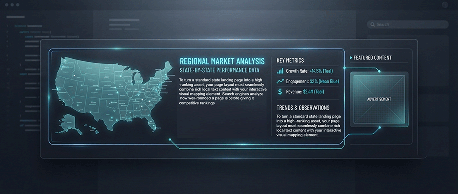
To turn a standard state landing page into a high-ranking asset, your page layout must seamlessly combine rich local text content with your interactive visual mapping element. Search engines analyze how well-rounded a page is before giving it competitive rankings.
- Above-the-Fold Engagement: Place your interactive state map high up on the page so visitors see it immediately without scrolling. This instantly lowers your bounce rate.
- Geographic Proximity Headers: Surround your map with optimized H2 and H3 subheadings containing explicit state-level variations, such as localized service descriptions or regional main offices.
- NAP Data Integration: Ensure your Name, Address, and Phone Number (NAP) details for that specific state are written in clean text blocks directly below the map container so search crawlers can easily match them with your map pins.
Avoiding Thin, Duplicate State Pages
Search engines have strict standards against auto-generated content and "doorway pages"—thin pages created purely to capture search rankings without offering real value. If you create 50 identical pages for 50 states and only swap out the name of the state, search engines will recognize the pattern and your rankings will suffer across the whole set.
To avoid this, each state-level page must be genuinely unique and helpful:
- State-Specific Case Studies: Write brief summaries of real projects or client successes unique to that specific state territory.
- Local Regulations or Insights: Include information regarding regional laws, climate factors, or local market insights that only apply to residents of that state.
- Dynamic, Helpful Interaction: By using your map plugin to give users a high-value tool where they can actively look up regional resources, you satisfy Google’s "Helpful Content" standard effortlessly.
3. Enhancing User Experience for Regional Directories and Franchises
Frictionless Territory Navigation
For businesses operating franchise networks, regional directories, or multi-state sales teams, user experience lives or dies by speed of navigation. If a customer lands on your site and has to scroll through a disorganized, text-heavy directory list to find their local contact, they face immediate cognitive fatigue.
By replacing long, static lists with clean geographic boundaries, you establish an environment built for frictionless territory navigation. Visitors do not have to guess which office handles their area; they simply point, click, and interact with the physical territory layout on the screen. This immediate ease of use guides the visitor to the correct regional contact funnel in just one step, preserving their attention span and driving up localized conversion rates.
Dynamic State Filters
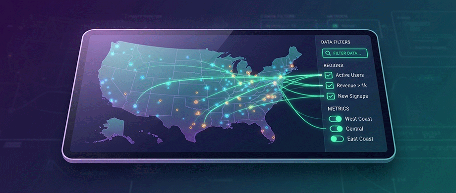
The key to turning a simple visual map into an indispensable business tool is giving users total control over how they filter regional data. Instead of forcing readers to reload an entire webpage just to view a new branch, your interface should process local searches live on the page.
Utilizing a premium tool like the US State Map WordPress Plugin allows you to unlock high-value, dynamic sorting features:
- Instant Hover Feedback: State territories cleanly shift colors or highlight boundaries the moment a user moves their mouse cursor across the map canvas.
- Immediate Update: Once you save the changes, the updates are reflected to the live map.
By providing this lightning-fast interactive control panel, your WordPress site keeps readers engaged longer and gives visitors a genuine reason to explore more of your content.
4. Optimizing Schema Markup for Multi-State Businesses

LocalBusiness Structured Data
While human visitors see the beautiful interactive visual map on the front end, search engine crawlers rely heavily on backend metadata to verify geographical details. To bridge this gap, your WordPress site must use Schema markup—specifically LocalBusiness or PostalAddress structured data.
Schema markup is a universal language used by search engine algorithms to read and interpret your real-world business attributes without guessing. When you explicitly state your exact latitude, longitude, city, and state boundaries inside your site's header code, you remove all ambiguity. Providing this organized, machine-readable data ensures that search engines confidently index and match your individual state pages with local, high-intent user searches.
Map Schema Alignment
To maximize your local SEO footprint, your technical metadata should directly align with your front-end user experience elements:
- The
hasMapSchema Property: The official Schema.org vocabulary includes a dedicated property called hasMap. By inserting the exact URL of your interactive state map page into the hasMap field of your schema code, you create a direct link between your digital code and your visual assets. - Earning Rich Snippets: This alignment helps search engines pick up your local branch details for visual search features, such as the Google Local Pack (the map snippet that sits above standard organic text links).
- Building Consistent Business Information: Keeping your visible map interface and your underlying structured data in sync ensures search engines display accurate, trustworthy business details wherever your listing appears — a small technical detail that reinforces the credibility of your whole site.
5. Tracking and Measuring Local Map Conversions

Monitoring Regional Clicks
Deploying interactive state maps is an excellent way to capture user interest, but to unlock their full potential, you must actively track how users interact with them. By setting up event tracking scripts (such as Google Analytics 4 custom events), you can monitor exactly where your traffic is looking.
Tracking every click, zoom, and tooltip activation gives you invaluable user behavior data:
- Identifying Popular Markets: You can track exactly which specific states or regional pins get clicked the most by your real-world visitors.
- Pinpointing Dead Zones: If certain states are never hovered over or interacted with, it tells you that your content or local presence in that region needs a strategy shift.
- Measuring Actionable Goals: Tracking how many map clicks successfully lead users to fill out contact forms or view localized landing pages gives you a clear look at your true conversion rates.
Refining Local Content Strategies
The engagement data you collect from your map interactions acts as a direct blueprint for your upcoming blog content strategy. If you notice a massive spike in clicks on your midwestern state maps, for example, it signals a strong regional demand for your business services there.
You can use these behavioral insights to systematically build deep, localized topical authority that search engines love:
- Expanding Regional Articles: Write targeted case studies and state-specific guidebooks for the geographic territories that show the highest map engagement.
- Prioritizing Your Best-Performing Pages: Identify which state landing pages get the most organic traffic and engagement, then invest further content and internal linking effort there first — these are your highest-leverage pages for growth.
- Smart Business Growth: Use your map data to confidently decide which states, cities, or territories to physically target next for your business expansion.

About the Author
Botrous Kerolos has been designing and building interactive maps for the web since 2009 — from early Flash/SWF maps to modern SVG — and leads development at WP Map Plugins, helping WordPress sites turn static content into fast, accessible, interactive experiences.