
Documentation
Install a map, place it with a block, widget, or shortcode, edit areas, and upgrade to premium. The editor is the same for every map.
One guide for every map. These docs use the US map as the example. Every WP Map Plugins map works the same way, so the same steps, settings, and shortcodes apply to yours. Just swap in your map’s name, for example [wpmp-europe-map] instead of [wpmp-us-map].
Getting started
Every WP Map Plugins map is a regular WordPress plugin. The free version and premium install the same way.
- Download the plugin zip. For the US map, use Download the free version on the product page.
- In WordPress, go to Plugins → Add New Plugin → Upload Plugin, choose the zip, then click Install Now and Activate.
- Open the map’s menu in the WordPress admin, for example US Map, and design your map.
- Click Publish, then place the map on a page.
Requirements for version 3.1.3: WordPress 6.3 or later and PHP 7.4 or later. Tested up to WordPress 7.1.
Placing the map
Use whichever method fits your site:
- Gutenberg block: add the map’s block, for example Interactive US Map, in the block editor.
- Elementor widget: drag the map widget into your layout.
- Shortcode: paste the map’s shortcode into any page, post, or widget area. The US map uses
[wpmp-us-map]; the Europe map uses[wpmp-europe-map].
The map is inline SVG on your own site: no iframe and no third-party map API.
Editing areas
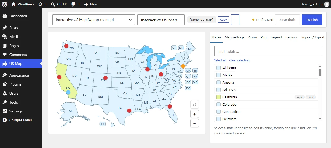
The visual editor has a live preview that works exactly like the published map.
- Pick areas from the list, or search for them, and edit them in the side panel. You can select several areas and change them together.
- Set the color, hover color, and label color of each area.
- Write a tooltip. In the free version a tooltip is one line of plain text.
- Under When clicked, choose Open a link (in the same tab or a new tab) or Nothing.
- Use Map settings for map-wide options such as the inactive color, border color and width, and tooltip colors.
Changes go live on your site when you click Publish.
Import and export
- JSON exports and imports all settings of a map. Use it to back up a map or copy it to another site.
- CSV exports a spreadsheet of all areas. Edit it in Excel or Google Sheets and import it again. Empty cells keep the current values.
Both are included in the free version.
Premium features
- Formatted tooltips: bold text, colors, lists, and a small image.
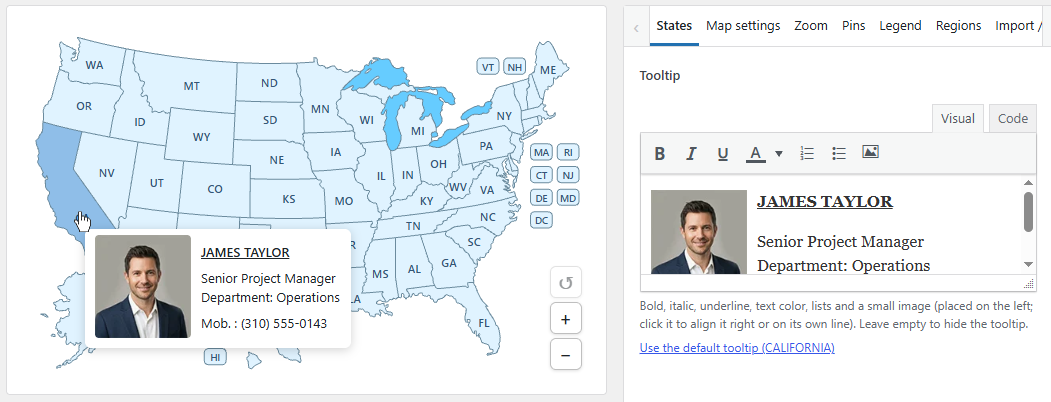
Formatted tooltips can include bold text, colors, lists, and a small image. - Modal window / popups with images, links, and video.
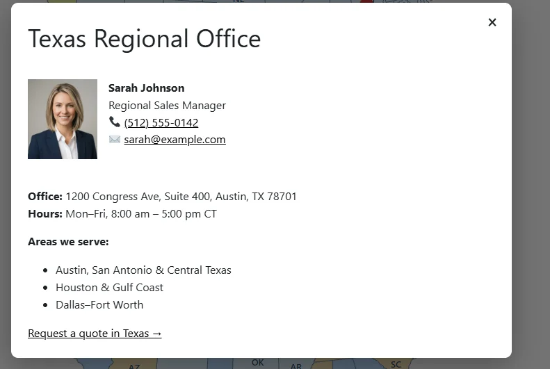
Popups provide more space for text, images, links, and video. - Pins on top of the map.
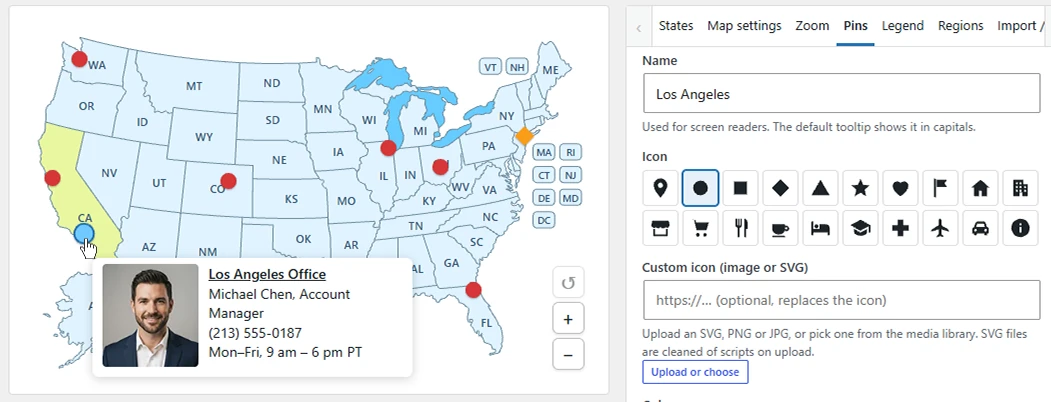
Place pins on top of the map to mark specific locations. - Regions: group areas so they highlight together and share a color, tooltip, and click.
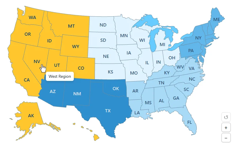
Group areas into a region with a shared color, tooltip, and click action. - Legend (optional): explains what the colors mean, under the map.
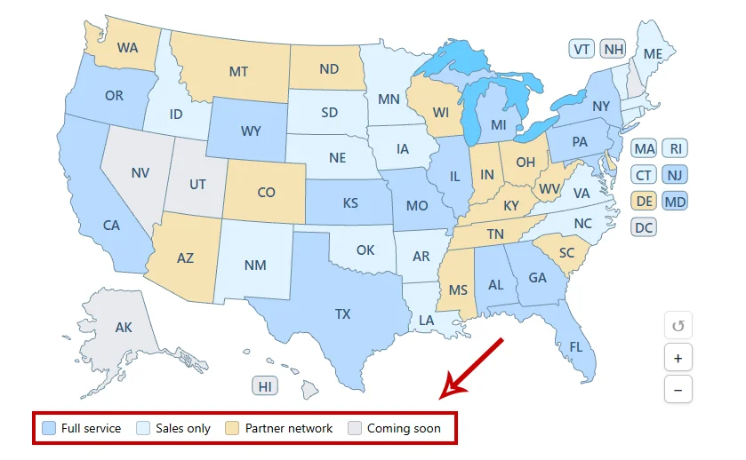
An optional legend explains the map colors. - Zoom and pan (optional).
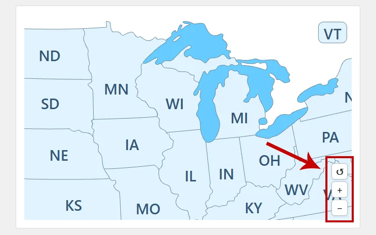
Optional zoom and pan controls let visitors explore the map. - Several maps on one site or page, each with its own shortcode, such as
[wpmp-us-map-2].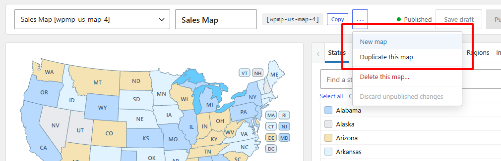
Create several map configurations, each with its own shortcode. - Custom labels and fonts: change the text on an area, or leave it empty to hide that label, and the label font, size, and weight.
- CSS classes per area.
Keep tooltips short. When you need more room, links, or media, use a popup: tooltips close when the pointer leaves or the area is clicked, so nothing inside a tooltip can be clicked.
Upgrading to premium
Premium is a one-time payment with no subscription and no license key. Future updates of the premium plugin are included.
If you already use the free plugin, install premium and activate it. It replaces the free copy and keeps your map settings.
Removing the plugin
Your maps are not deleted when you delete the plugin, unless you turn on Delete all maps when the plugin is deleted in the map settings. Maps are not deleted while another edition of the same map is still installed.
FAQ
Is there a credit link?
The free download shows a small credit link under the map. In premium the link is off unless you turn it on.
Will the map slow down my site?
The map is inline SVG and the front end does not use jQuery.
Can a tooltip contain a link?
No. Link the area itself, or use a premium popup for text, links, images, and video.
US map notes
The Interactive US Map includes all 50 states plus the District of Columbia, which is its own clickable region. Alaska and Hawaii are part of the same map.
Nine smaller or crowded states use callout boxes so their labels stay readable: Connecticut, Delaware, Hawaii, Maryland, Massachusetts, New Hampshire, New Jersey, Rhode Island, and Vermont. Hovering or clicking a label highlights that state the same way as clicking the shape. The Great Lakes are a separate layer and are not clickable.
US territories are not included. For Puerto Rico, Guam, and the other territories, see the Interactive US Map with Territories plugin.
Still stuck? Contact us and tell us which map you are using.